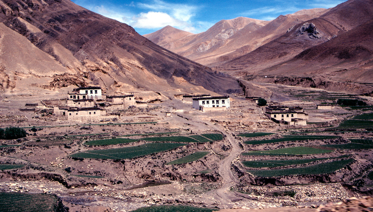
Roadside village between Shigatse and Dingri in 2000.[Photo by Bruce Connolly/chinadaily.com.cn]
When an earthquake hits an area that is familiar, a place of fond memories, it somehow becomes more personal. Such was the situation on Jan 3, 1996, when a severe earthquake struck the mountain town of Lijiang in northwestern Yunnan. An area I have many fond memories of spending time there the previous year. Similarly, on Jan 7 this year, another earthquake hit a remote area of Xizang, known as Dingri. Listening to the news, my thoughts went back to the moment in travel during June 2000, heading up to the Base Camp of Mount Qomolangma, known as Mount Everest in the West. I had stopped in Dingri for lunch on both the outward and inward journey. I recalled the friendship of people I had briefly met there.
What would be the final fatality rate be? How much damage will have occurred to property and infrastructure? Time will tell. It is a vast, mostly lightly populated area, partly due to high altitude and low precipitation. That should have reduced potential loss of life. However, there has been significant development in recent years due to the growth of mainly domestic, tourism. The popularity of road trips across China has made this area, in particular, a favorite route for adventurous driving.
The epicenter of this 7.1 magnitude quake, appears to be within Dingri county, which comes under the administration of Shigatse, Xizang's second-largest city after Lhasa. Hence it is being referred to as the "Shigatse Earthquake". That city, however, is about a four hour 240 kilometer drive from Dingri. The earthquake would have been felt there although it is considerably away from more intensely affected areas. Shigatse city is renowned for its Tashilhunpo Monastery, a major tourist attraction today.
This area, as indeed much of southwestern China, is sadly earthquake prone. Its magnificent scenery is related to plate tectonics. This includes, of course, Mount Qomolangma and its neighboring super tall peaks along with the mountains ranges of Sichuan and Yunnan. Over vast eras of geological time, South Asia has been slowly, but steadily pushing northwards. This has resulted in a slow, almost imperceptible uplift of the extensive Qinghai-Tibetan Plateau. That is until a serious earthquake occurs resulting in violent, powerful movements of the earth's crust.
Around Dingri I was approached by locals offering rocks and small fossils found in the surrounding hills. Very limited vegetation cover exposes amazing folds and cracks in the rocks that were due to the massive uplifts. It seems incredible to appreciate that there was a "sea'"where today the Himalayas now reach up to the world's highest peak, 8,849 meter high Qomolangma.

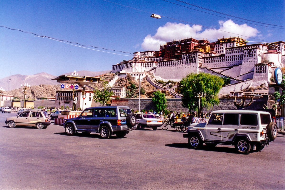
The Potala Palace. Photo taken in 2000. [Photo by Bruce Connolly/chinadaily.com.cn]
When I traveled through the area, almost 25 years ago, infrastructure was generally not developed, compared with today. Roads were mostly unpaved, often with steep, unprotected drops down to raging rivers. Often they presented difficult conditions even for experienced motorists. I really respected the professionalism and skills of my local Tibetan driver!
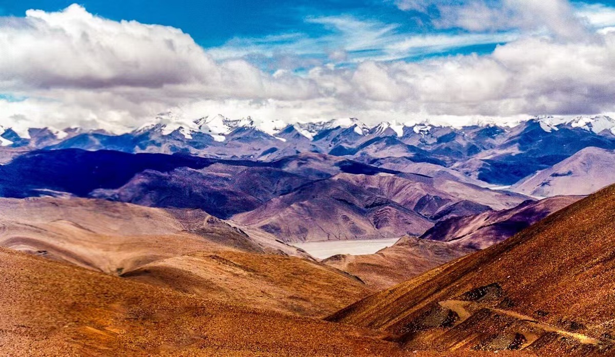
One road I followed was through the Yarlung Tsanpo river gorges between Lhasa and Shigatse. That highway, G318, runs from Shanghai to Nepal border. Beyond Dingri, a turn off leads south, along a smaller road, before winding up through a series of switchbacks to 5,200 meter high Pang-La Pass. From there are stunning views of Mount Qomolangma. The road drops beyond the pass, eventually reaching the famed base camp at the start of mountaineering routes up to that peak.

View from Pang-La Pass in 2000. [Photo by Bruce Connolly/chinadaily.com.cn]
My time in Xizang, lasting 15 days, allowed me to see much of the region. I quickly became aware of considerable work underway to improve, indeed to create a modern infrastructure. So many communities, particularly in the remote areas, were living away from direct access to roads. Indeed rivers were often crossed by wire rope pulleys, which I certainly did not want to attempt! I saw considerable highway and bridge construction. Roads were being paved, indeed many sections rebuilt, with the network consequently becoming much safer. Also, administrative towns were built across the region, allowing access to improved public services.
During my time, I observed development programs where more affluent eastern provinces and cities were twined with parts of Xizang. For example, Shanghai was twinned with Shigatse, Beijing with Lhasa and in southeastern areas, Fujian had a noticeable presence. They were helping with planning and indeed constriction of infrastructure. Today, modern highways have helped open up the region, away from earlier difficult isolation.
Railway construction, although geographically challenging, has been another priority. In 1997, I had reached Golmud (Germu) in Qinghai. Then, a small town and terminus of the Qinghai-Tibet Railway. Lhasa was 1,169 kilometers onwards by road! In 2006 that city and indeed Xizang, was finally linked, by rail with the rest of China. Since then, in 2014, a line connected Lhasa with Shigatse followed by another in 2021, heading south to Nyingchi. That railway will eventually reach Chengdu in Sichuan.
Another achievement has been with aviation. In earlier days, flying into Gonggar Airport, which serves Lhasa, was challenging due to local weather issues. Flights were very limited, with only two operating daily to and from Chengdu. Now, modern jet aircraft, specially adapted for high altitude operation, connect directly with several cities across China. Shigatse also has an airport, opening in 2010 as Xizang's fifth.
Infrastructure construction has proved a major factor in opening up the region, for example with tourism. It has also proven to be invaluable in facilitating emergency response. This has been noticeable in recent days with this recent Shigatse earthquake. Large transport aircraft were able to carry in essential salvage equipment along with experienced rescue teams. People could also be evacuated more quickly compared to situations before such modern facilities existed.
Sadly, the factors leading to this recent earthquake are part of nature. It is recognized that geology gives, but geology also takes! The earth movements have created the mountains that draw many tourists annually to such areas. However, sudden, strong plate activities can be very destructive for property, infrastructure and sadly too often are fatal.
Lijiang, I remember my feelings learning of its 1996 earthquake. Returning there regularly, I was impressed how it was rebuilt and increasingly a popular destination. In 2017, I also saw how parts of Sichuan, previously devastated by the 2008 earthquake have also been rebuilt. Hopefully the area around Xizang's Dingri will be restored with prosperity returning.
Bruce Connolly is a photographer and writer from Scotland who has lived in China for over 30 years. The views don't necessarily represent those of China Daily.
If you have a specific expertise, or would like to share your thought about our stories, then send us your writings at opinion@chinadaily.com.cn, and comment@chinadaily.com.cn.