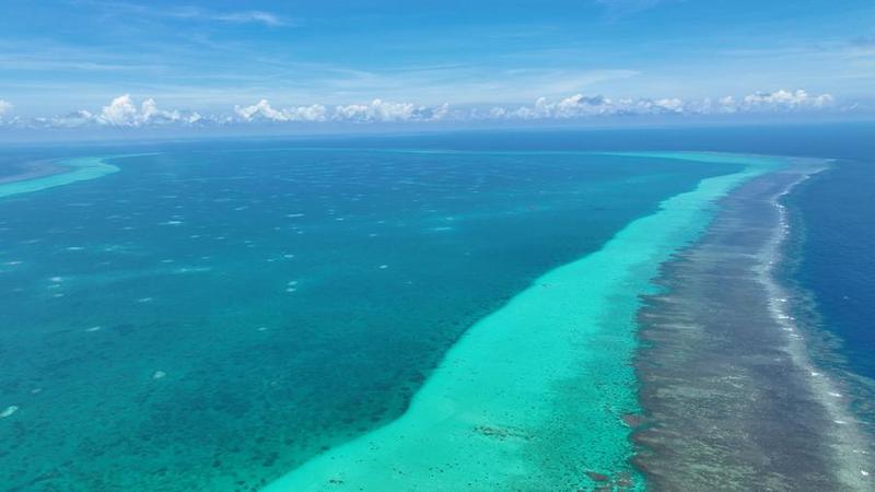
A view of China's Huangyan Dao. [Photo/Xinhua]
China released baselines for the territorial sea adjacent to Huangyan Dao on Sunday, a move to lawfully strengthen marine management and counter infringement actions by the Philippines.
The delimitation and declaration of the territorial sea baselines is a natural step by the Chinese government and is consistent with international law and common practices, the Foreign Ministry said in an online statement on Sunday.
A spokesperson stressed in the statement that Huangyan Dao has always been China's territory.
The baselines of the territorial sea adjacent to the island were delimited and announced in accordance with international law, such as the United Nations Convention on the Law of the Sea and the Law of the People's Republic of China on the Territorial Sea and the Contiguous Zone, the spokesperson said.
The announcement came two days after the Philippines enacted the so-called "Philippine Maritime Zones Act", which the spokesperson said severely violates China's territorial sovereignty as well as its maritime rights and interests in the South China Sea.
The Philippine act aims to further solidify the illegal arbitral award on the South China Sea in the form of domestic legislation and to illegally include China's Huangyan Dao and most of the islands and reefs of China's Nansha Islands and their relevant waters in the Philippines' maritime zones, the spokesperson said.
China firmly opposes this and will continue to do everything necessary in accordance with law to firmly defend its territorial sovereignty and maritime rights and interests, the spokesperson added.
The territorial sea baseline is the starting line for coastal countries to establish maritime jurisdiction claims, and it normally follows the low-water line of a coastal state.
According to the United Nations Convention on the Law of the Sea, coastal states can have a territorial sea width of 12 nautical miles (22.22 kilometers).
The last time China made such an announcement was in March, when the Chinese government issued a statement delineating the baseline of the northern part of the Beibu Gulf in the South China Sea.
Also on Sunday, the China Coast Guard blasted the frequent provocations by Manila at Huangyan Dao and in its adjacent waters.
China has been consistently, peacefully and effectively exercising sovereignty and jurisdiction over Huangyan Dao, the China Coast Guard said in a statement.
Recently, however, the Philippines has frequently dispatched military vessels and aircraft, as well as government ships, to intrude into the surrounding sea and airspace of Huangyan Dao and stir up trouble, which seriously infringes on China's territorial sovereignty and maritime rights, the statement said.
Furthermore, Manila has encouraged its fishing boats to enter the lagoon at Huangyan Dao for illegal fishing activities, according to the statement.
The China Coast Guard said some Philippine fishing vessels have engaged in illegal practices, such as using toxic substances to catch fish and fishing for endangered aquatic life, that damage the fragile ecosystem of the surrounding waters.
In accordance with relevant domestic and international laws, the China Coast Guard will continue to strengthen patrols and law enforcement within the territorial waters and surrounding areas of Huangyan Dao, the statement said.
The China Coast Guard will firmly maintain order in the relevant maritime areas, protect the ecological environment and biological resources of these waters, and resolutely safeguard national territorial sovereignty and maritime rights and interests, it added.
In another development, the Ministry of Natural Resources announced for the first time on Sunday the standard names for several islands and reefs in the South China Sea.